Bu Gia Map National Park
At the southern end of the Central Highlands and the beginning of the Southeastern region, nature remains largely untouched by human activity, so many areas still retain their wild and pristine beauty. This region is especially rich in rare and endangered species of animals and plants, including some endemic ones. Bu Gia Map National Park is one of those precious places.
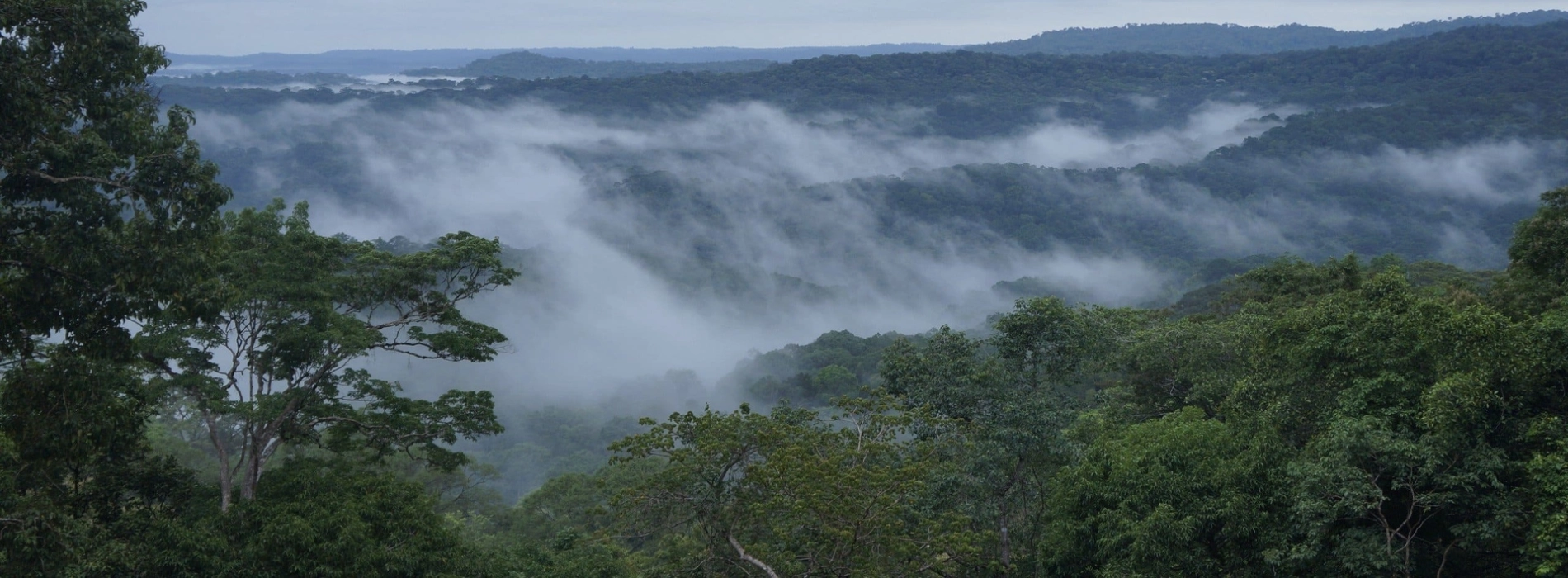
The pristine beauty of Bu Gia Map National Park
The national park spans an area of 260 square kilometers, encompassing a diverse range of forest types. In addition to conservation, it also serves purposes such as scientific research, environmental education, and the development of eco-tourism services.
When you visit, you'll get the chance to observe the unique transitional ecosystem between two major regions of Vietnam. Join Asia King Travel and set off on an adventure to uncover what secrets lie hidden beneath the leaves!
Bu Gia Map National Park is located between Binh Phuoc and Dak Nong provinces, near the border with Cambodia. Bu Gia Map District, Dong Xoai City, Binh Phuoc Province currently manages it. From the city center, you’ll need to travel about 90 kilometers north to reach the park.
After landing at Tan Son Nhat Airport in Ho Chi Minh City, head onto Truong Chinh Street and merge onto Dai Han Expressway. Then, turn left onto Le Van Khuong Street. Continue along Dang Thuc Vinh Street to Provincial Road 9, which will take you to Thu Dau Mot City in Binh Duong Province. Follow Hoang Van Cu Street, then continue on Pham Ngoc Thach Street, and finally exit the city via Hung Vuong Street.
At the end of Hung Vuong Street, you'll reach Vo Van Kiet Street. Turn right, and you'll come to the intersection with Provincial Road 741. Follow this road, and it will lead you directly to Dong Xoai City. Continuing on Provincial Road 741 will take you through the city, then Phuoc Long Town, and finally bring you to the ranger checkpoint at the entrance of Bu Gia Map National Park.
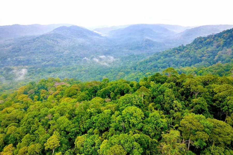
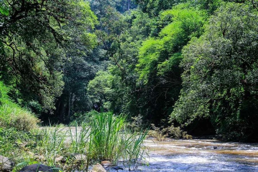
The forest covers a vast area of land
Besides using a personal vehicle, you can also opt for a sleeper bus for a safer and more budget-friendly option. Several bus companies offer routes from Ho Chi Minh City to Dong Xoai City or directly to the national park, with ticket prices around VND 220,000 per person. The journey takes approximately 4 to 5 hours.
With the typical southern climate that stays warm year-round, the national park has a relatively stable temperature of around 25–26°C, making it ideal for sightseeing and exploring the landscape. That means you can plan your visit at any time of the year. The forest has high humidity, so you may feel a bit stuffy and get dehydrated quickly during your trip, but that can be easily managed by bringing along proper gear and enough supplies.
For a smoother trip, it’s best to visit during the dry season, specifically from November to early May. It’s recommended to avoid going to Bu Gia Map National Park during the rainy season, as travel can become difficult due to wet and slippery conditions.
Suggested for you: Vietnam Tour 21 days: Less touristic holiday
Bu Gia Map National Park lies in the transitional zone from the Central Highlands down to the Southeastern lowlands, giving it distinct geographical features with hills, mountains, rivers, and streams. The terrain is mainly composed of low hills, with elevation gradually decreasing from Dak Nong to Binh Phuoc. Mountain ranges are often interwoven with streams, creating beautiful waterfalls throughout the area.
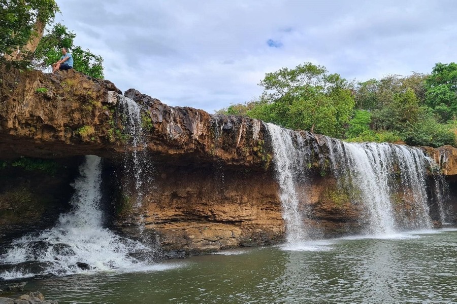
Dak Mai Waterfall is the most breathtaking sight to behold
Dak Mai Waterfall in the national park was voted one of the top 7 most stunning tourist destinations in Vietnam in 2023. The waterfall spans a width of 25 to 45 meters and drops from a height of 7 to 10 meters. What makes it truly unique is the way the water flows over a cave with an opening, causing it to pour straight down like a giant natural shower.
The diversity of plant life becomes habitats suitable for many animal species. As a result, Bu Gia Map National Park has recorded a high level of animal biodiversity. According to statistics, the park is home to more than 437 species. Among the 73 mammal species found here, 59 are listed in Vietnam’s Red Data Book, including bears, leopards, and elephants. Additionally, 10 bird species in the park are currently threatened with extinction.
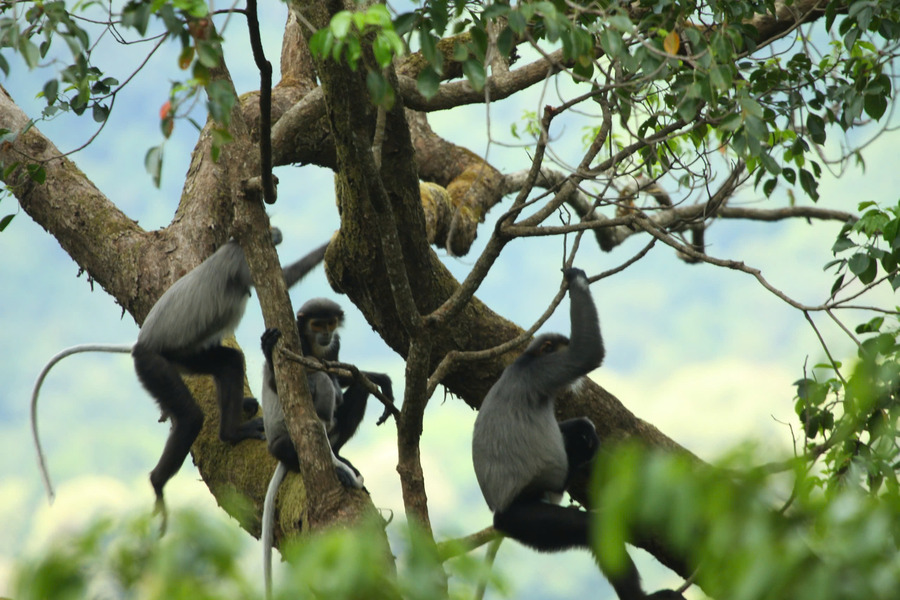
Many wildlife species have been discovered and are in need of conservation
Currently, two ethnic groups live in the area of the national park: the Stieng and the M'Nong, both carrying the cultural identity of the Central Highlands. These communities still preserve many traditional practices for visitors to experience, such as gong festivals, traditional horn playing, the protection of sacred forests, brocade weaving, and crafting traditional tools. In addition, when visiting, you’ll also get the chance to enjoy their unique local delicacies.
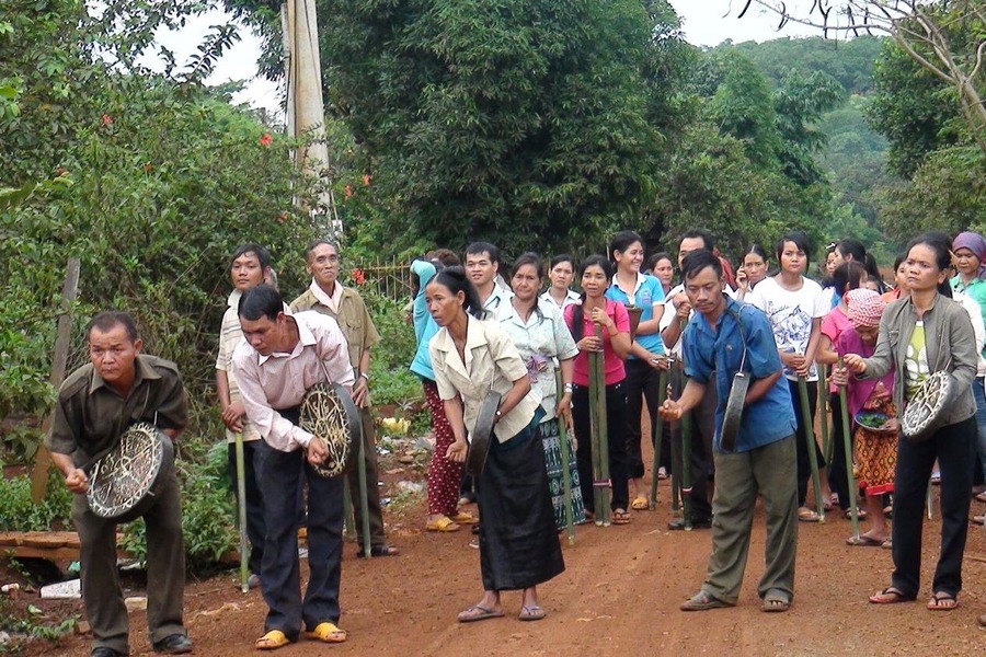
Gong Festival of S'tieng people
From the ranger station, a vehicle will take you to the trekking starting point. The trekking routes are clearly marked and offer plenty of recreational spots along the way, in addition to the beautiful natural scenery, ensuring you and your friends will have a fun and memorable time together.
You can spend the night in the forest in tents to fully immerse yourself in its beauty and enjoy the most memorable experiences. Alternatively, they can explore the forest during the day and stay overnight in a traditional S’tieng longhouse, where they can join in cultural exchanges featuring gong music, campfires, bamboo dancing, and drinking ruou can (traditional rice wine) with the local people.
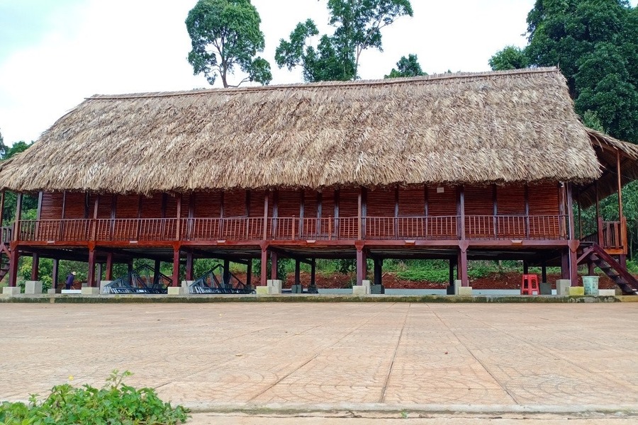
You can stay overnight in a S'tieng longhouse
Bu Gia Map National Park is both a nature conservation area and a cultural preservation site of the Central Highlands - Southeast region. Contact Asia King Travel and we’ll make sure you have the most unforgettable experience here.
Suggested for you: Central Highlands Vietnam Tour 9 days: Nature of the highland